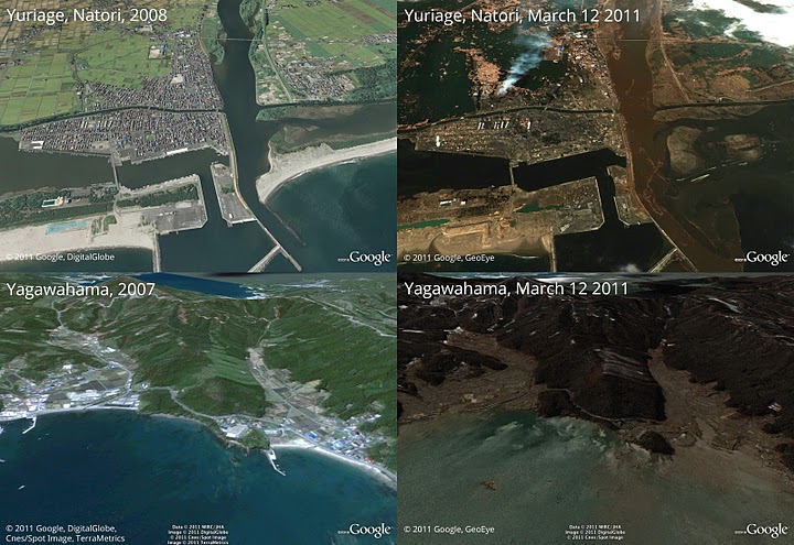
Google Maps’ pictures of the earthquake in Japan
by Tug Agency | 14.03.2011
Google Maps has updated its satellite with images after the earthquake and tsunami. These pictures show the before and after the earthquake and tsunami:
The images are also available in high resolution on Picasa, Google’s digital photo service.


